mapsMaps ETC Site map
 Maps ETC > Astronomical > Solar System > Apparent Path of the Sun, 1920
Site Map 

Apparent Path of the Sun, 1920

Apparent Path of the Sun


Title: Apparent Path of the Sun
Projection: Unknown,
Source Bounding Coordinates:
W: E: N: S:

Main Map Page
Zoomify Version
B/W PDF Version
Color PDF Version
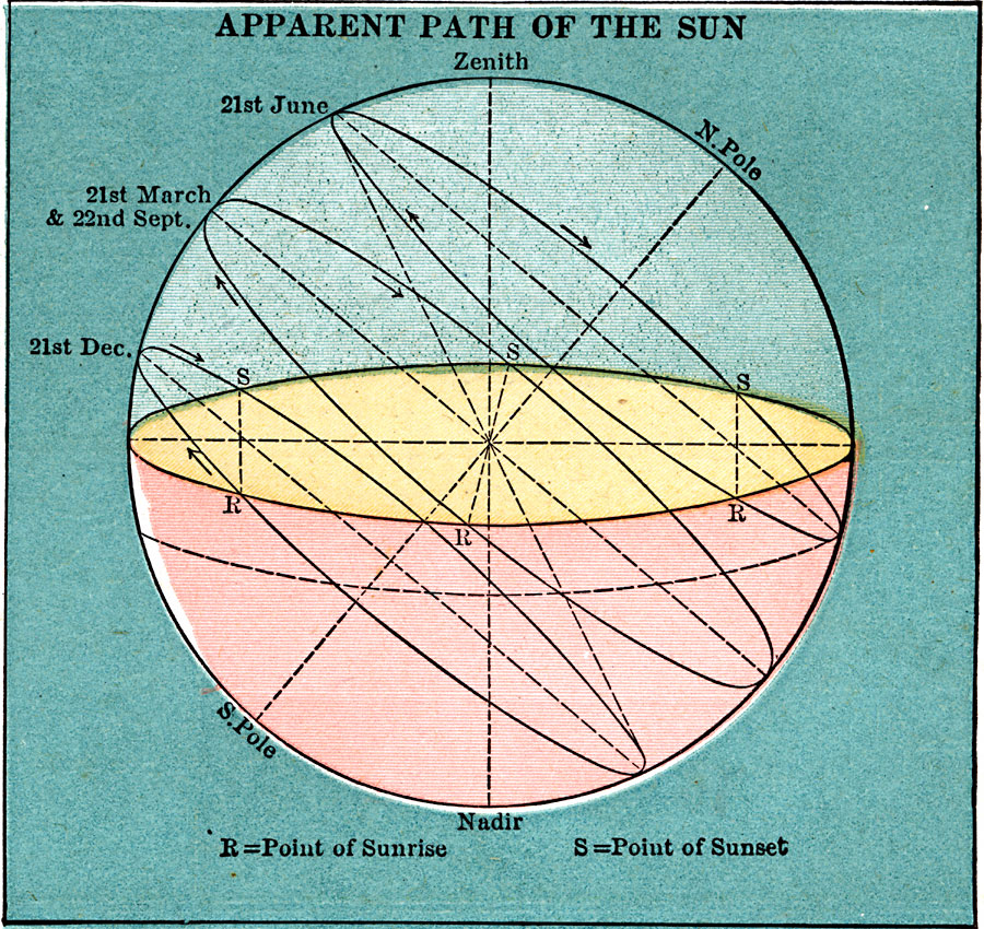
Description: The apparent path of the sun throughout the year.
Place Names: Solar System, North Pole, South Pol
ISO Topic Categories:
Keywords: Apparent Path of the Sun, Zenith, 21st June, 21st March, 22nd September, 21st December, Point of Sunrise, Point of Sunset, Zenith, Nadir, Unknown, 1920
Source: , Leslie's New World Atlas (New York City, New York: Leslie-Judge Company, 1920) 104
Map Credit: Courtesy the private collection of Roy Winkelman
SearchLicensePDF HelpGIS Help Google Earth Help Zoomify Help

 Maps ETC > Astronomical > Solar System > Apparent Path of the Sun, 1920
Site Map