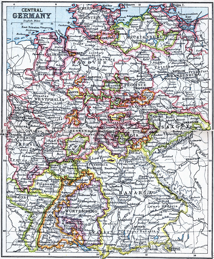
Description: A map of Central Germany in 1910 showing cities, towns, ports, railroads, rivers and terrain of the region. The map is color–coded to show the individual states that made up Germany at the time.
Place Names: Germany, Bavaria, �Hannover, �Mecklenburg, �Saxony, �Wurtemburg, �Wiesbade
ISO Topic Categories: inlandWaters,
location,
oceans
Keywords: Central Germany, physical, �physical features, �topographical, �political, �country borders, topographical,
physical features, country borders, inlandWaters,
location,
oceans, Unknown, 1910
Source: J.G. Bartholomew, LLD, A Literary & Historical Atlas of Europe (New York, New York: E.P. Dutton & Co., Ltd. , 1910) 76-77
Map Credit: Courtesy the private collection of Roy Winkelman |
|