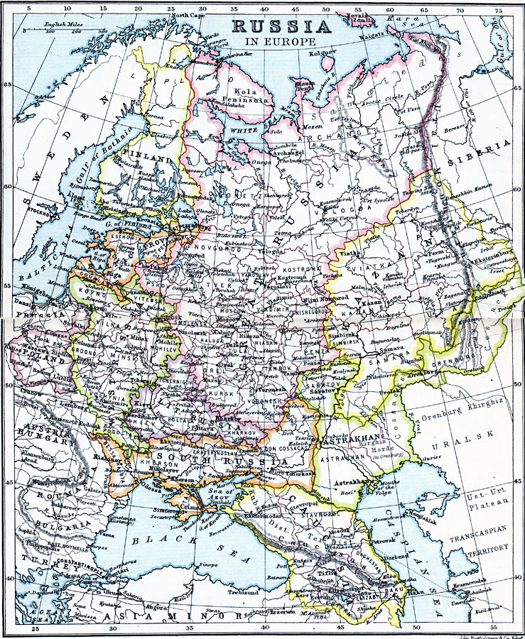
Description: A map of Russia in Europe in 1910 showing the provinces of Finland, Greater Russia, Baltic Provinces (Esthonia, Courland, Livonia, and St. Petersburg), Poland, Western Russia, Little Russia, South Russia, Caucasia, Astrakhan, and Kazan. The map shows territorial boundaries within the provinces, major cities, railways, rivers, large bodies of water, and mountain systems.
Place Names: Eastern Europe, Astrakhan, �Austria, �Bulgaria, �Caucasia, �Finland, �Khazan, �Poland, �Prussia, �Roumania, �Russia, �Siberia, �Romani
ISO Topic Categories: inlandWaters,
location,
oceans
Keywords: Russia in Europe, physical, �physical features, �topographical, �political, �country borders, topographical,
physical features, country borders, inlandWaters,
location,
oceans, Unknown, 1910
Source: J.G. Bartholomew, LLD, A Literary & Historical Atlas of Europe (New York, NY: E.P. Dutton & Co., Ltd. , 1910) 90-91
Map Credit: Courtesy the private collection of Roy Winkelman |
|
