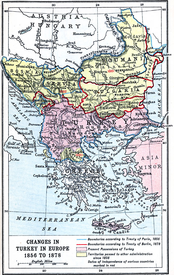
Description: A map of southeastern Europe showing the changes in Turkish borders between 1856 and 1878, and the establishment of independent countries in 1881 and 1882. This map shows the Ottoman Empire's northern boundaries in blue as they were established by the Treaty of Paris in 1856 following the Crimean war between Russia and the Turks. The red borders were established by the Treaty of San Stefano and revised by the Treaty of Berlin, both signed in 1878, bringing an end to the Russo–Turkish War of 1877–78. In 1881 Roumania (Romania) declared its sovereignty, while Thessaly reverted back to Greek control, and in 1882 Servia declared its independence.
Place Names: Southeastern Europe, Albania, �Constantinople, �Macedonia, �Roumelia, �Turkey, Roumania, Servia, Bosnia, Montenegro, Bulgaria, Eastern Roumelia, Thessaly
ISO Topic Categories: inlandWaters,
location,
oceans,
boundaries
Keywords: Changes in Turkey in Europe, physical, �physical features, �topographical, �political, �country borders, topographical,
physical features, country borders, inlandWaters,
location,
oceans,
boundaries, Unknown, 1856–1878
Source: J.G. Bartholomew, LLD, A Literary & Historical Atlas of Europe (New York, NY: E.P. Dutton & Co., Ltd. , 1910) 93
Map Credit: Courtesy the private collection of Roy Winkelman |
|