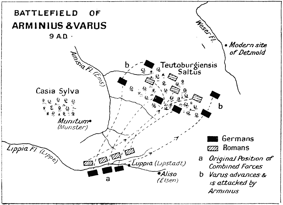
Description: A map of the Battle of the Teutoburg Forest in the present day Lower Saxony of Germany. The battle was between the Roman Legion under Publius Quinctilius Varus, and the armies of a coalition of Germanic tribes led by Arminius. This battle was fought in AD 9, resulting in a defeat for the Roman Legion, and establishing the Rhine River as the boundary between the Roman Empire and the barbarian tribes.
Place Names: Germany, Germany, �Munster, Munitum, Luppia, Lipstadt, Aliso, Elsen, Detmold, Teutoburg Fores
ISO Topic Categories: inlandWaters,
location,
oceans
Keywords: Battle of Teutoburg Forest , battle, �historical, �military, kBattle, kRomanEmpire, historical event,
other military, inlandWaters,
location,
oceans, Unknown, A.D. 9
Source: J.G. Bartholomew, LLD, A Literary & Historical Atlas of Europe (New York, New York: E.P. Dutton & Co., Ltd. , 1910) 115
Map Credit: Courtesy the private collection of Roy Winkelman |
|