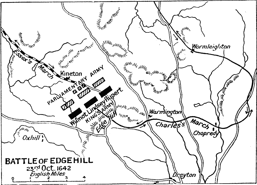
Description: A map of the Battle of Edgehill in southern Warwickshire during the First English Civil War. The battle was between the Royalists under Charles I of England, and the Parliamentarians led by the Earl of Essex. This battle was fought on 23rd October, 1642, essentially the first battle of the Civil War, and failed to produce a conclusive victory for either side.
Place Names: United Kingdom, Chopredy, �Drayton, �Edgehill, �England, �Kineton, �Warmington, �Wormleighton, � ��United Kingdo
ISO Topic Categories: inlandWaters,
location,
oceans
Keywords: Battle of Edgehill, battle, �historical, �military, kBattle, kEnglishCivilWar, historical event,
other military, inlandWaters,
location,
oceans, Unknown, October 23, 1642
Source: J.G. Bartholomew, LLD, A Literary & Historical Atlas of Europe (New York, New York: E.P. Dutton & Co., Ltd. , 1910) 124
Map Credit: Courtesy the private collection of Roy Winkelman |
|