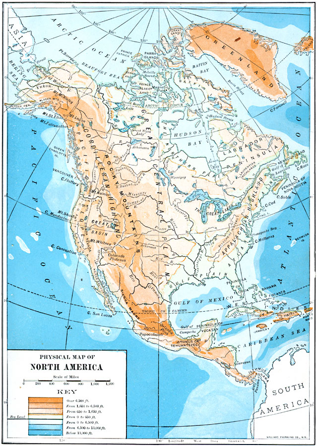
Description: A map from 1910 of North America, Central America, Greenland, and the Caribbean to Puerto Rico showing general land elevations, water depths, and principal terrain features. The map uses color–contouring to show land elevations from sea level to over 6,500 feet, and water depths to below 13,000 feet. The principal highlands, mountain systems, plains, river systems, and coastal features are shown.
Place Names: A Complete Map of North America, United States, �Mexico, �Cuba, �Canada, �Bahama
ISO Topic Categories: elevation,
location,
oceans,
inlandWaters
Keywords: North America, physical, physical features, elevation,
location,
oceans,
inlandWaters, Unknown, 1910
Source: Ralph S. Tarr, B.S., F.G.S.A. and Frank M. McMurry, Ph.D., New Geographies 2nd ed (New York, NY: The Macmillan Company, 1910) 4
Map Credit: Courtesy the private collection of Roy Winkelman |
|