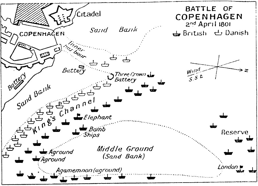
Description: Map shows the Battle of Copenhagen, 2nd April, 1801, between the British fleet under the command of Admiral Parker and Vice–Admiral Horatio Nelson, and the Danish fleet during the War of the Second Coalition.
Place Names: Denmark, Agamemnon, �Citadel, �Copenhagen, �England, �King's Channel, �Trafalgar, �United Kingdo
ISO Topic Categories: inlandWaters,
location,
oceans
Keywords: Battle of Copenhagen, battle, �historical, �military, kBattle, kLordNelson, kNapoleonicWars, historical event,
other military, inlandWaters,
location,
oceans, Unknown, April 2, 1801
Source: J.G. Bartholomew, LLD, A Literary & Historical Atlas of Europe (New York, New York: E.P. Dutton & Co., Ltd. , 1910) 127
Map Credit: Courtesy the private collection of Roy Winkelman |
|