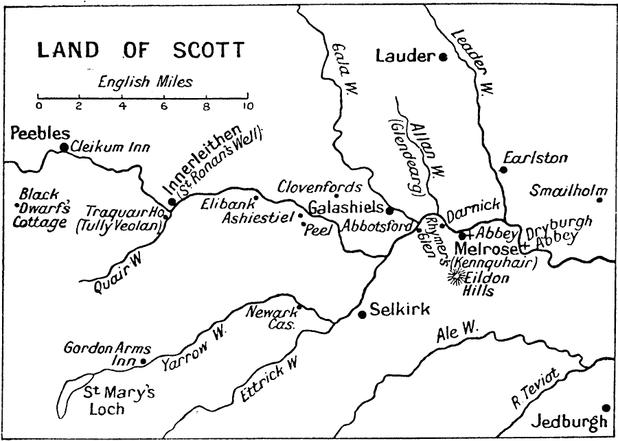
Description: A map showing the countryside of the Scottish novelist Sir Walter Scott (1771–1832). The map shows Dryburgh Abbey, where he is buried, and many of the rivers and towns mentioned in his literary works, including Innerleithen and Cleikum Inn (St. Ronan's Well), Traquair (A Letter from Tully Veolan), Abbey Melrose and Kennquhair (The Monastery and The Abbot) and the Black Dwarf's Cottage.
Place Names: United Kingdom, Innerleithen, �Lauder, �Peebles, �Scotland, �Selkirk,
ISO Topic Categories: inlandWaters,
location,
oceans
Keywords: Land of Scott, historical, kLiterature, inlandWaters,
location,
oceans, Unknown, 1910
Source: J.G. Bartholomew, LLD, A Literary & Historical Atlas of Europe (New York, New York: E.P. Dutton & Co., Ltd. , 1910) 129
Map Credit: Courtesy the private collection of Roy Winkelman |
|