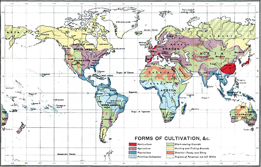
Description: A map from 1915 showing the various forms of agricultural cultivation and land use across the world. This map is color–coded to show regions of horticulture, agriculture, plantations, primitive cultivation, stock–rearing grounds, and hunting and fishing grounds. The map also shows regions of sandy or stone deserts, and regions of perpetual ice.
Place Names: A Complete Map of Globes and Multi-continent, South America, �North America, �Europe, �Australia, �Asia, �Antarctica, �Afric
ISO Topic Categories: inlandWaters,
oceans,
location,
boundaries,
farming
Keywords: Forms of Cultivation, physical, �political, �borders, �statistical, �agriculture, �farming, kAgriculture, physical features, country borders, agriculture, inlandWaters,
oceans,
location,
boundaries,
farming, Unknown, 1915
Source: J.G. Bartholomew, A School Economic Atlas (London, England: Oxford University Press, 1915) 8
Map Credit: Courtesy the private collection of Roy Winkelman |
|