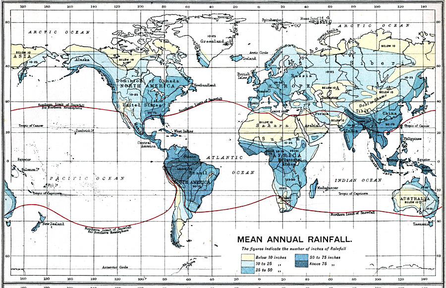
Description: A map from 1915 showing the mean annual rainfall throughout the world. This map is color–coded to show areas where the number of inches of rainfall ranges from below 10 inches to above 75 inches. Within each colored area, figures show the average annual number of inches of rainfall. Red lines show the southern limits of snowfall in the northern hemisphere and northern limit in the southern hemisphere.
Place Names: A Complete Map of Globes and Multi-continent, South America, �North America, �Europe, �Australia, �Asia, �Antarctica, �Afric
ISO Topic Categories: inlandWaters,
oceans,
location,
boundaries
Keywords: Mean Annual Rainfall, physical, �political, �borders, �hydrological, �water table, �meteorological, �rainfall, kClimate, physical features, country borders, rainfall, water table, inlandWaters,
oceans,
location,
boundaries, Unknown, 1915
Source: J.G. Bartholomew, A School Economic Atlas (London, England: Oxford University Press, 1915) 9
Map Credit: Courtesy the private collection of Roy Winkelman |
|