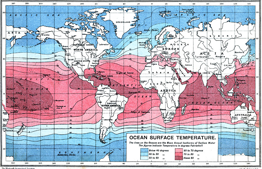
Description: A world map from 1915 showing ocean surface temperatures across the earth. The map shows isotherm lines of mean annual temperatures given in degrees Fahrenheit, and is color–coded to show cold temperatures from below 40° to 60° F. (blues) and warm temperatures from 60° to above 80° F. (pinks).
Place Names: A Complete Map of Globes and Multi-continent, South America, �North America, �Europe, �Australia, �Asia, �Antarctica, �Afric
ISO Topic Categories: inlandWaters,
oceans,
location,
boundaries
Keywords: Ocean Surface Temperature, physical, �political, �borders, �hydrological, �meteorological, �water, �temperature, kClimate, physical features, country borders, temperature, water table, inlandWaters,
oceans,
location,
boundaries, Unknown, 1915
Source: J.G. Bartholomew, A School Economic Atlas (London, England: Oxford University Press, 1915) 9
Map Credit: Courtesy the private collection of Roy Winkelman |
|