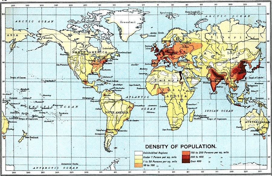
Description: A world map from 1915 showing density of population throughout the world. This map is color–coded to show uninhabited regions, regions of population with density under 1 person per square mile, to regions of population density of over 400 persons per square mile.
Place Names: A Complete Map of Globes and Multi-continent, South America, �North America, �Europe, �Australia, �Asia, �Antarctica, �Afric
ISO Topic Categories: inlandWaters,
oceans,
location,
boundaries,
economy,
society
Keywords: Density of Population, physical, �political, �borders, �statistical, �population, �society, �demographics, kPopulation, physical features, country borders, population, inlandWaters,
oceans,
location,
boundaries,
economy,
society, Unknown, 1915
Source: J.G. Bartholomew, A School Economic Atlas (London, England: Oxford University Press, 1915) 12
Map Credit: Courtesy the private collection of Roy Winkelman |
|