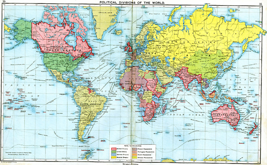
Description: A map from 1915 showing the political divisions of the world at that time on a Mercator's Projection. This map is color–coded to show territories and islands under possession of the British Empire, United States, German Empire, Russian Empire, France, Portugal, Netherlands, and China. The names of smaller territories and islands under the British Empire are underlined in red. Major cities are shown, as well as principal railways, rivers, and steamship routes with distances between major ports given in nautical miles.
Place Names: A Complete Map of Globes and Multi-continent, South America, �North America, �Europe, �Australia, �Asia, �Antarctica, �Afric
ISO Topic Categories: inlandWaters,
oceans,
location,
boundaries,
society
Keywords: Political Divisions of the World, physical, �political, �borders, �divisions, �boundaries, �politics, kMapProjection, physical features, country borders,
major political subdivisions, inlandWaters,
oceans,
location,
boundaries,
society, Unknown, 1915
Source: J.G. Bartholomew, A School Economic Atlas (London, England: Oxford University Press, 1915) 14-15
Map Credit: Courtesy the private collection of Roy Winkelman |
|