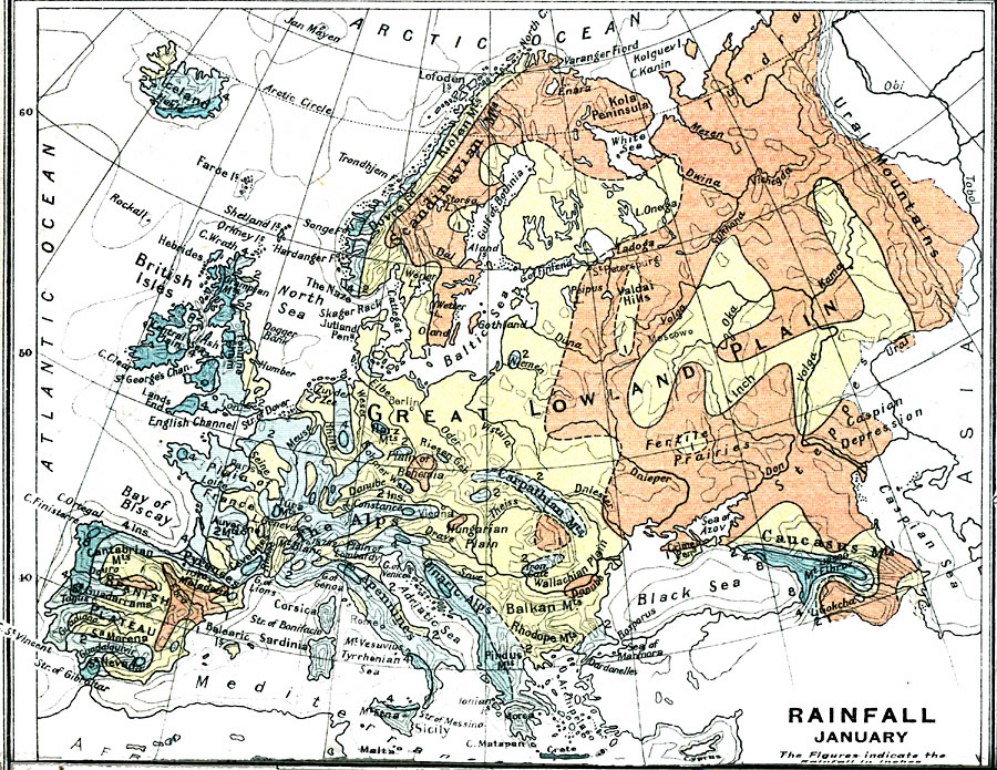
Description: A climatic map of Europe showing the average rainfall for the area in January measured in inches. Since rainfall in January is rare at the higher Latitudes, the figures should be taken to represent precipitation equivalents. The map also shows the climate effect of the proximity to coastal waters, and the various landforms that effect local climate, such as plains, lowlands, and mountain systems.
Place Names: A Complete Map of Europe, Europe, �Spain, �United Kingdom, �Germany, �France, �Sweden, �Italy, �Romania, �Greece, �Poland, �Portuga
ISO Topic Categories: inlandWaters,
oceans,
location,
boundaries,
society,
climatologyMeteorologyAtmosphere
Keywords: Rainfall in Europe - January, physical, �political, �borders, �meteorological, �rainfall, kClimate, physical features, country borders, rainfall, inlandWaters,
oceans,
location,
boundaries,
society,
climatologyMeteorologyAtmosphere, Unknown, 1915
Source: J.G. Bartholomew, A School Economic Atlas (London, England: Oxford University Press, 1915) 18
Map Credit: Courtesy the private collection of Roy Winkelman |
|