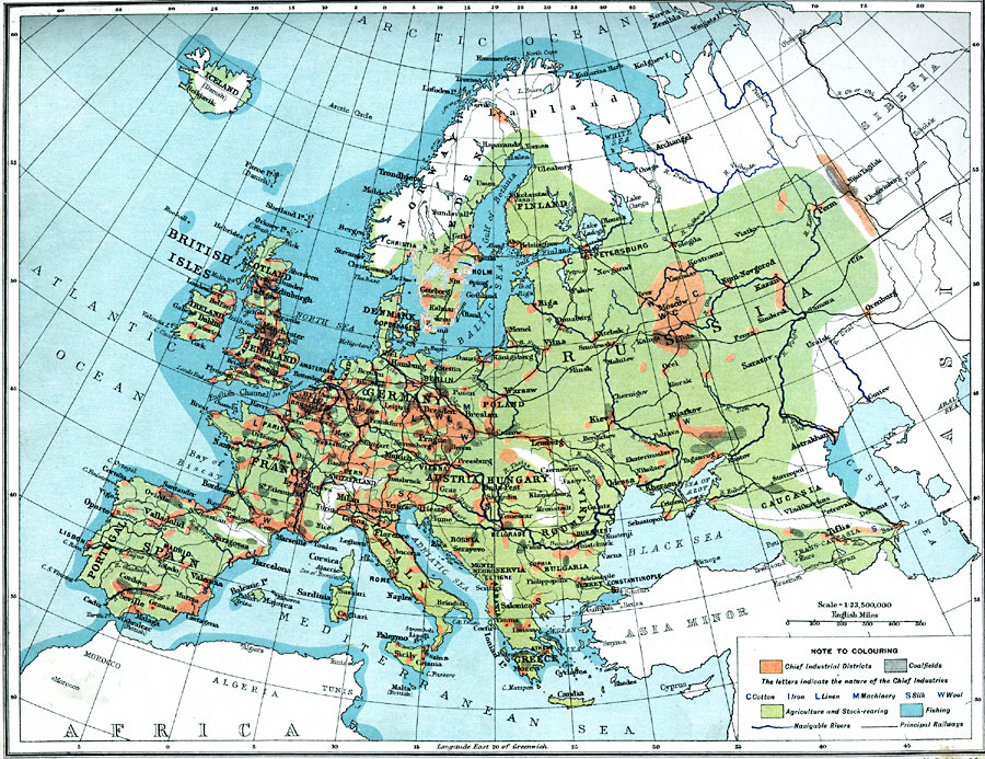
Description: A map from 1915 of Europe showing the principal industrial districts in the region. The map shows principal cities, railroads, and navigable rivers, and is keyed to show the chief industrial districts, agricultural and stock–rearing districts, coalfields, fishing grounds, and areas of cotton, iron, linen, machinery, silk, and wool production.
Place Names: A Complete Map of Europe, Europe, �Spain, �United Kingdom, �Germany, �France, �Sweden, �Italy, �Romania, �Greece, �Poland, �Portuga
ISO Topic Categories: inlandWaters,
oceans,
location,
boundaries,
society,
farming,
economy
Keywords: Industrial Map of Europe, physical, �political, �borders, �boundaries, �statistical, �industry, �farming, �economic, physical features, country borders, economic,
industry, inlandWaters,
oceans,
location,
boundaries,
society,
farming,
economy, Unknown, 1915
Source: J.G. Bartholomew, A School Economic Atlas (London, England: Oxford University Press, 1915) 21
Map Credit: Courtesy the private collection of Roy Winkelman |
|