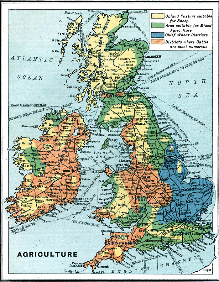
Description: A map from 1915 showing the principal areas of agriculture throughout the British Isles. The map is color–coded to show areas of upland pasture suitable for sheep, areas suitable for mixed agriculture, the chief wheat growing districts, and the districts where cattle are most numerous. Important products are given in the area of production. The map shows principal cities and ports, railroads, steamship and ferry routes, rivers, and coastal features.
Place Names: British Isles, Europe, �United Kingdo
ISO Topic Categories: inlandWaters,
oceans,
location,
boundaries,
economy
Keywords: British Isles – Agriculture, physical,�political, �borders, �boundaries,�statistical, �industrial, �industry, �agriculture, ��physical features, country borders, industry, inlandWaters,
oceans,
location,
boundaries,
economy, Unknown, 1915
Source: J.G. Bartholomew, A School Economic Atlas (London, England: Oxford University Press, 1915) 25
Map Credit: Courtesy the private collection of Roy Winkelman |
|