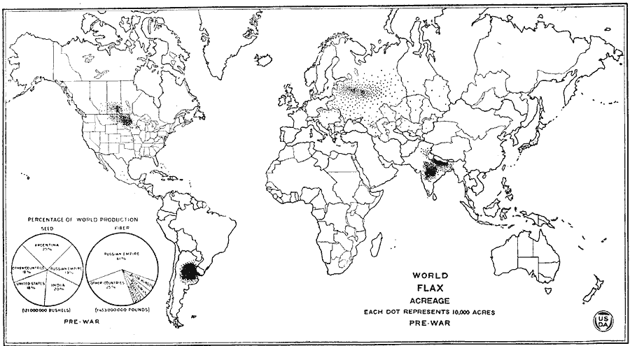
Description: A map showing world flax acreage in the Pre–WWI time period.
Place Names: A Complete Map of Globes and Multi-continent, Africa, �Asia, �Australia, �Europe, �North America, �South Americ
ISO Topic Categories: boundaries,
oceans,
farming,
inlandWaters
Keywords: World Flax Acreage Pre-WWI, physical, �political, �statistical, �world flax acreage pre-wwi, flax farming area pre world war one, physical features, major political subdivisions,
country borders, agriculture, boundaries,
oceans,
farming,
inlandWaters, Unknown, 1914
Source: , United States Department of Agriculture Yearbook 1922 (Washington D.C., Washington D.C.: Government Printing Office, 1923) 534
Map Credit: Courtesy the private collection of Roy Winkelman |
|