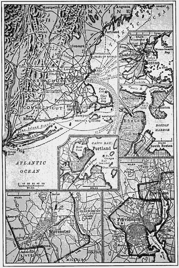
Description: A series of maps of the New England region, including an inset of the vicinity of Boston, a detail of Boston Harbor, a detail of Portland, Maine, a detail of the vicinity of Worcester, Massachusetts, and the vicinity of Providence, Rhode Island. The map shows the prominence of shipping from Boston, and the number of neighboring cities within a 50–mile and 100–mile radius of the city.
Place Names: New England States, Boston, �Worcester, �Providence, �Portlan
ISO Topic Categories: boundaries,
location,
oceans,
inlandWaters,
transportation
Keywords: New England , physical, �political, �transportation, physical features, major political subdivisions,
local jurisdictions, roads,
railroads,
water routes, boundaries,
location,
oceans,
inlandWaters,
transportation, Unknown, 1910
Source: Ralph S. Tarr, B.S., F.G.S.A. and Frank M. McMurry, Ph.D., New Geographies 2nd ed (New York, NY: The Macmillan Company, 1910) 44
Map Credit: Courtesy the private collection of Roy Winkelman |
|