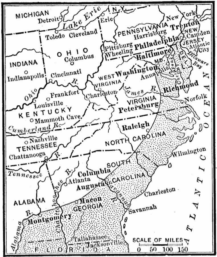
Description: A map from 1910 of the eastern region of the United States showing the natural feature known as the Fall Line of the Atlantic Coastal Plain. There are rapids and falls along this line because the streams have been able to dig more rapidly into the soft layers of the Coastal Plains than into the harder rocks of the Piedmont Plateau. Early European settlers located along the Fall Line, partly because of the waterpower and partly because the rapids and falls created a major obstacle to boats traveling upstream from the coast. Many of these original settlements along the Fall Line have become major cities of today.
Place Names: Eastern States, Atlanta, �Raleigh, �Trenton, �Philadelphia, �Washington D.C., �Piedmont, �Atlantic States, �Eastern Seaboar
ISO Topic Categories: geoscientificInformation,
inlandWaters,
location,
oceans
Keywords: The Fall Line, physical, �political, physical features, major political subdivisions, geoscientificInformation,
inlandWaters,
location,
oceans, Unknown, 1910
Source: Ralph S. Tarr, B.S., F.G.S.A. and Frank M. McMurry, Ph.D., New Geographies 2nd ed (New York, NY: The Macmillan Company, 1910) 49
Map Credit: Courtesy the private collection of Roy Winkelman |
|