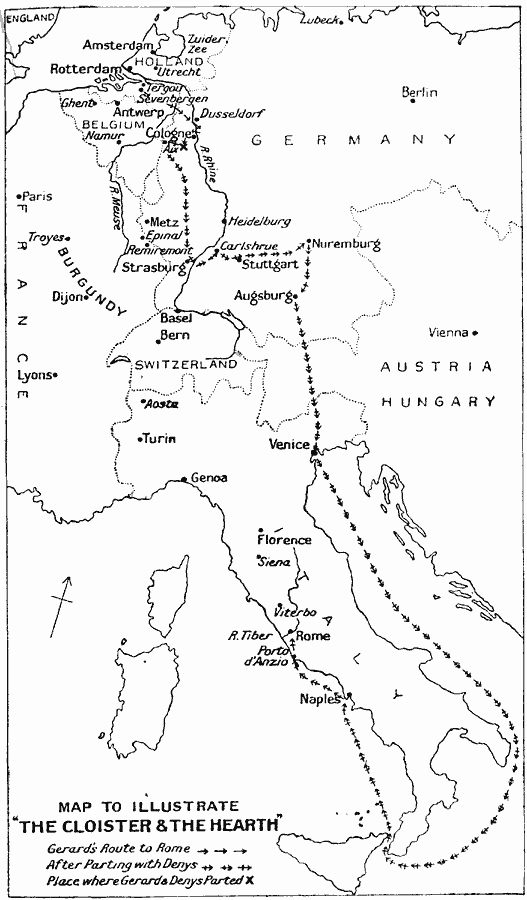
Description: A map to Illustrate Charles Reade's 1861 novel "The Cloister & The Hearth." This map shows Gerard's route in the 15th Century from Holland, the point at which Gerard and Denys part, and the Gerard's route to Rome after parting with Denys. Many of the cities mentioned in the novel are shown.
Place Names: Miscellaneous Europe, Amsterdam, �Belgium, �France, �Germany, �Holland, �Hungary, �Italy, �Rome, �Switzerlan
ISO Topic Categories: location
Keywords: Map to Illustrate "The Cloister & The Hearth", historical, kLiterature, location, Unknown, 15th Century
Source: J.G. Bartholomew, LLD, A Literary & Historical Atlas of Europe (New York, NY: E.P. Dutton & Co., Ltd. , 1910) 139
Map Credit: Courtesy the private collection of Roy Winkelman |
|