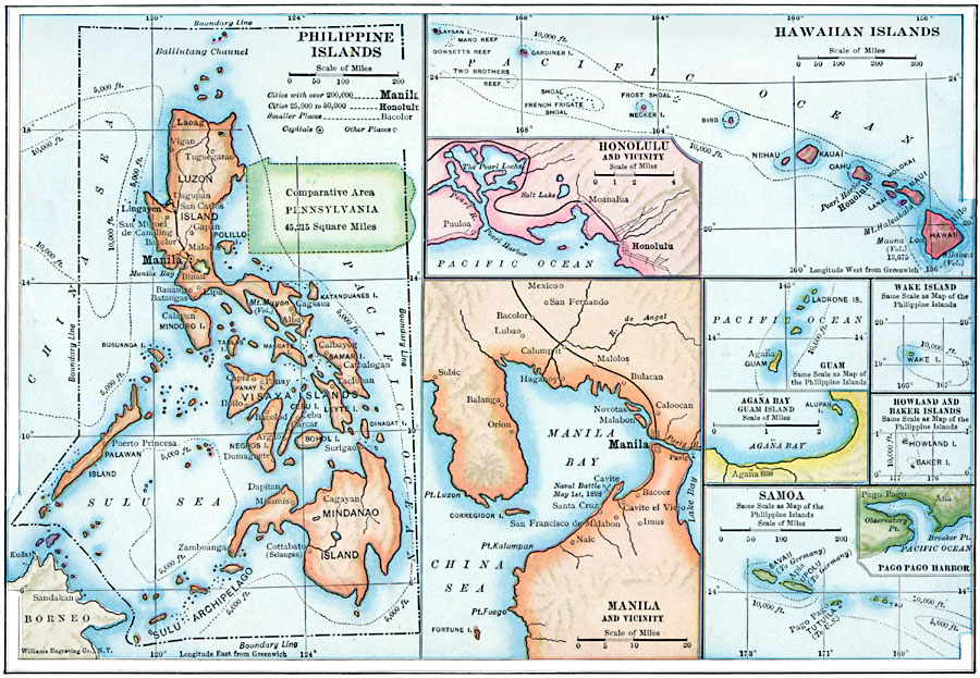
Description: United States dependencies in the Pacific Ocean in 1910.
Place Names: Growth of Nation, Honolulu, �United States Possessions, �Pacific Ocea
ISO Topic Categories: inlandWaters,
location,
oceans
Keywords: U.S. Dependencies in the Pacific, political, �physical, �transportation, kComparativeArea, physical features, local jurisdictions,
country borders, railroads,
roads, inlandWaters,
location,
oceans, Unknown, 1910
Source: Ralph S. Tarr, B.S., F.G.S.A. and Frank M. McMurry, Ph.D., New Geographies 2nd ed (New York, NY: The Macmillan Company, 1910) 158
Map Credit: Courtesy the private collection of Roy Winkelman |
|