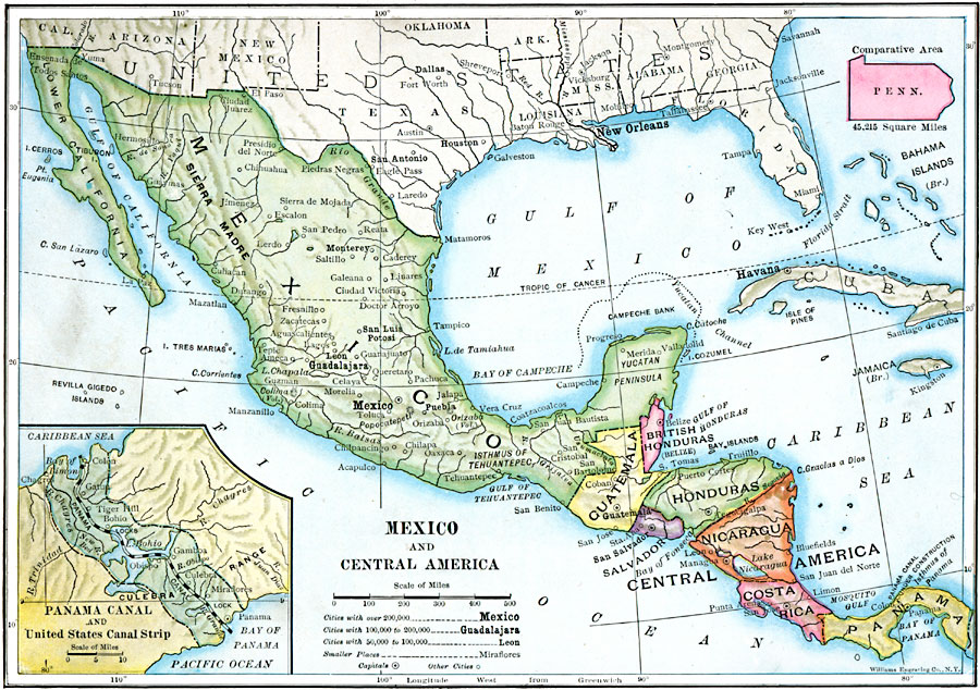
Description: A map from 1910 of Mexico and Central America showing political boundaries at the time, capitals and major cities, rivers, terrain and coastal features, reefs, and neighboring islands (Cuba and Jamaica). A map note shows the Panama Canal under construction, and an inset map details the Panama Canal and United States Canal Strip. An outline of Pennsylvania at the same map scale shows relative area size.
Place Names: A Regional Map of North America, Mexico, �Cuba, �Bahamas, �Honduras, �Guatemala, �El Salvador, �Nicaragua, �Costa Ric
ISO Topic Categories: boundaries,
location,
oceans,
inlandWaters
Keywords: Mexico and Central America, transportation, �physical, �political, kCentralAmerica, kComparativeArea, physical features, country borders, water routes, boundaries,
location,
oceans,
inlandWaters, Unknown, 1910
Source: Ralph S. Tarr, B.S., F.G.S.A. and Frank M. McMurry, Ph.D., New Geographies 2nd ed (New York, NY: The Macmillan Company, 1910) 171
Map Credit: Courtesy the private collection of Roy Winkelman |
|