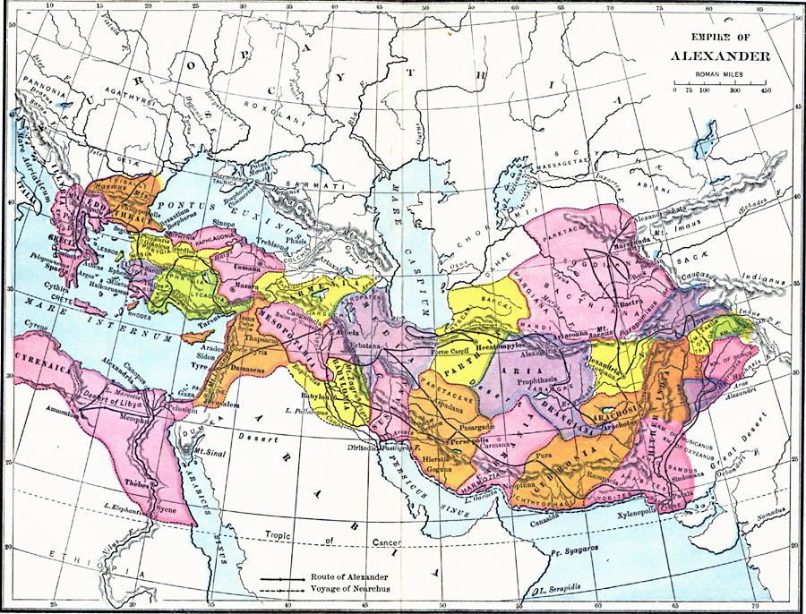
Description: A map of the Empire of Alexander the Great, showing the lands conquered or under his control by the time of his death in 323 BC, from the Danube River in Triballi (Bulgaria), south the Lake Elephantine near the first cataracts of the Nile in Egypt, and from Cyrenaica on the north coast of Africa to Paurava, the kingdom of Porus in what is today Punjab, India. The map also shows his routes from Pella in Macedonia to Thebes, to the Danube, his march to Egypt and the Desert of Libya, from Damascus to Babylon and through Persia and Afghanistan to India. The map also shows the sailing route of Alexander's admiral Nearchus from the Indus River through the Persian Gulf to the Euphrates River in Susiana. The map also shows the locations of several famous battle sites including Granicus, Sardis, Gordion (Gordian Knot), Issus, Persepolis, and others, as well as the many cities named Alexandria he founded, including Alexandreschata (Alexandria Eschate - The Furthest) in 329 BC.
Place Names: Regional Miscellaneous, Arachosia, �Armenia, �Babylonia, �Carmenia, �Gedrosia, �Grecia, �Media, �Mesopotamia, �Parthia, �Susiana, �Thrace
ISO Topic Categories: county borders, �historical, �political, kAlexandertheGreat, kWorldMedSea, kWorldAfroAsia, kWorldEurasia
Keywords: Empire of Alexander, county borders, �historical, �political, kAlexandertheGreat, county borders, county borders, �historical, �political, kAlexandertheGreat, kWorldMedSea, kWorldAfroAsia, kWorldEurasia, Unknown, 336 B.C. to 323 B.C.
Source: Victor Duruy, Edwin A. Grosvenor, & Louis E. Van Norman, Duruy's General History of the World (vol. I) (New York, NY: The Review of Reviews Company, 1912)
Map Credit: Courtesy the private collection of Roy Winkelman |
|