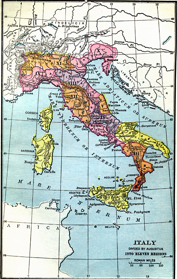
Description: A map of Roman Italy, or Italia in 7 BC, when, according to Pliny the Elder, Augustus Caesar divided Italia into eleven regions (regiones), Latium et Campania (I), Apulia et Calabria (II), Lucania et Brutii (III), Samnium (IV), Picenum (V), Umbria et Ager Gallicus (VI), Etruria (VII), Aemilia (VIII), Liguria (IX), Venetia et Histria (X), and Transpadana (XI). The map shows important cities of the time, major rivers, and terrain.
Place Names: Italy, Rome, �Sicily, �Veron
ISO Topic Categories: location
Keywords: Italy Divided by Augustus into Eleven Regions, county borders, �historical, �political, kRomanEmpire, county borders, location, Unknown, 7 BC
Source: Victor Duruy, Edwin A. Grosvenor, & Louis E. Van Norman, Duruy's General History of the World (vol. I) (New York, New York: The Review of Reviews Company, 1912)
Map Credit: Courtesy the private collection of Roy Winkelman |
|