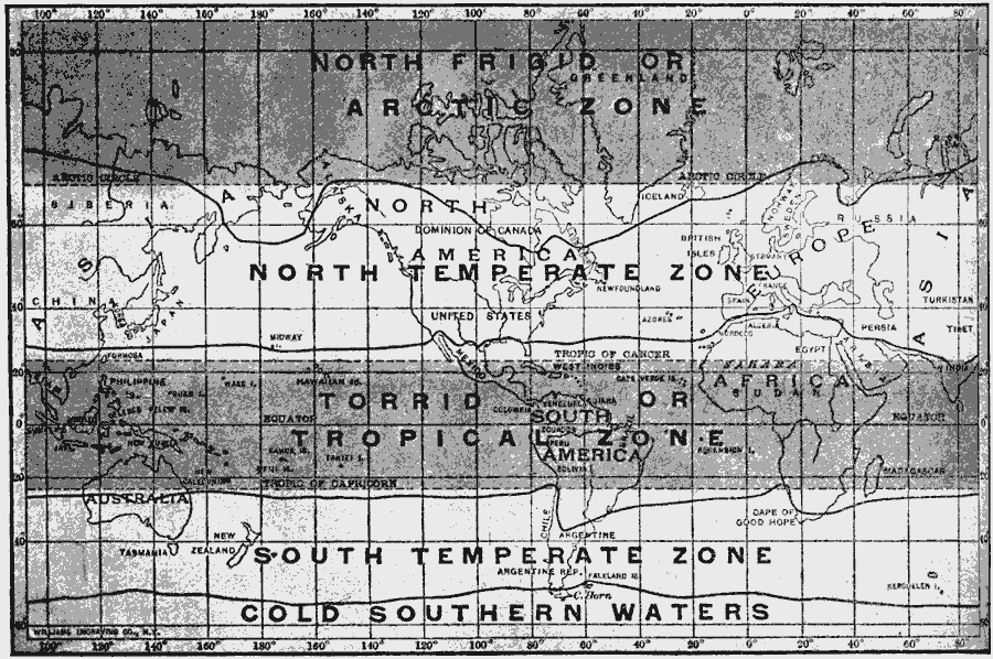
Description: A map of the world from 1910, showing the Earth's latitudinal climate zones (North Frigid or Arctic, North Temperate, Torpid or Tropical, South Temperate, and Cold Southern Water), and corresponding isotherm zones, illustrating how latitude does not necessarily determine climate (Iceland is below the latitudinal arctic circle, but above the arctic isotherm).
Place Names: A Complete Map of Globes and Multi-continent, Africa, �Antarctica, �Asia, �Australia, �Europe, �North America, �South Americ
ISO Topic Categories: climatologyMeteorologyAtmosphere,
location,
oceans,
inlandWaters
Keywords: A Map of the Climate Zones, physical, �meteorological, kClimate, physical features, climate, climatologyMeteorologyAtmosphere,
location,
oceans,
inlandWaters, Unknown, 1910
Source: Ralph S. Tarr, B.S., F.G.S.A. and Frank M. McMurry, Ph.D., New Geographies 2nd ed (New York, NY: The Macmillan Company, 1910) 200
Map Credit: Courtesy the private collection of Roy Winkelman |
|