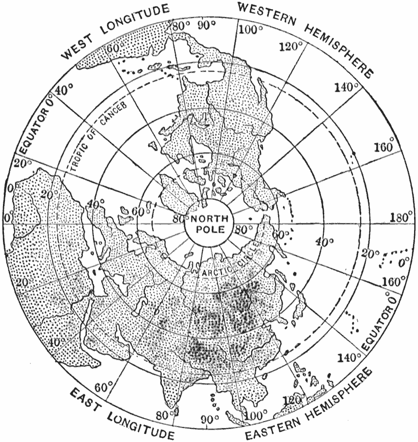
Description: A base map from 1910 looking down on the earth from the North Pole, to show how the meridians come to a point at the North Pole. Notice that if the 0 meridian were continued, it would unite with the meridian 180. The longitude circles of the Arctic Circle and Tropic of Cancer are shown, with the equator forming the circular outside edge of the map.
Place Names: Northern Hemisphere, Asia, �Europe, �North America, �Afric
ISO Topic Categories: location,
inlandWaters,
oceans
Keywords: View from the North Pole, physical, physical features, location,
inlandWaters,
oceans, Unknown, 1910
Source: Ralph S. Tarr, B.S., F.G.S.A. and Frank M. McMurry, Ph.D., New Geographies 2nd ed (New York, NY: The Macmillan Company, 1910) 204
Map Credit: Courtesy the private collection of Roy Winkelman |
|