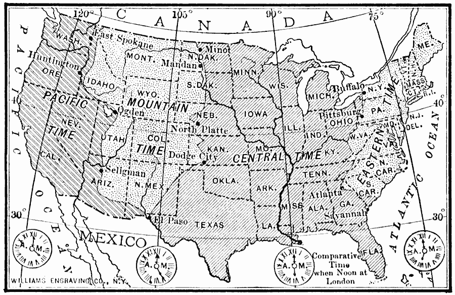
Description: A map from 1910 of the United States showing the time zones as they were then established. Clock–symbols at the bottom of the map show the comparative times when it is noon in London. "Formerly every city used its own sun time, or local time. This was a source of great trouble to travelers; for their watches were always wrong when they arrived at new places. When railroads were built, and people began to travel more, and to go longer distances, the many different kinds of local time became even a greater inconvenience. In order to avoid this trouble, our continent has been divided into belts, in each of which the railways, and most of the town have agreed to use the same time. Since this time is the standard for all, these belts are called the Standard Time Belts." — Tarr and McMurry, 1910, p. 205.
Place Names: A Complete Map of the United States, time zone
ISO Topic Categories: boundaries,
oceans,
location,
inlandWaters
Keywords: Standard Time in the United States, physical, �political, �time zones, physical features, major political subdivisions,
country borders, boundaries,
oceans,
location,
inlandWaters, Unknown, 1910
Source: Ralph S. Tarr, B.S., F.G.S.A. and Frank M. McMurry, Ph.D., New Geographies 2nd ed (New York, NY: The Macmillan Company, 1910) 205
Map Credit: Courtesy the private collection of Roy Winkelman |
|