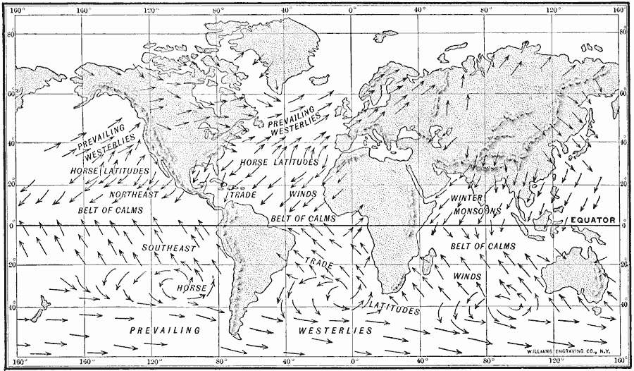
Description: A map from 1910 showing the principal wind belts and prevailing wind directions of the earth. This map shows the wind directions for the Prevailing Westerlies, Horse Latitudes, Northeast and Southeast Trade Winds, Belt of Calms, and Winter Monsoons.
Place Names: A Complete Map of Globes and Multi-continent, Africa, �Asia, �Australia, �Europe, �North America, �South Americ
ISO Topic Categories: climatologyMeteorologyAtmosphere,
inlandWaters,
location,
oceans
Keywords: Wind Belts of Earth, physical, �meteorological, �political, physical features, country borders, winds, climatologyMeteorologyAtmosphere,
inlandWaters,
location,
oceans, Unknown, 1910
Source: Ralph S. Tarr, B.S., F.G.S.A. and Frank M. McMurry, Ph.D., New Geographies 2nd ed (New York, NY: The Macmillan Company, 1910) 208
Map Credit: Courtesy the private collection of Roy Winkelman |
|