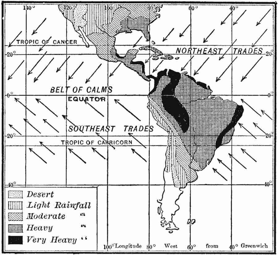
Description: A map of the Americas from 1910 showing the rainy east coasts and arid west coasts of the trade wind belts, and the rainy belt of calms of South America. This map is hatchured to show regions of desert, and regions of light to very heavy rainfall, and the prevailing wind directions of the northeast and southeast Trade Winds. Knowing the wind patterns is illustrated as key to understanding the principal rain belts of the region.
Place Names: Regional Americas, North America, �South Americ
ISO Topic Categories: physical, �meteorological, kWorldAmericas
Keywords: Rainfall in the Americas, physical, �meteorological, physical features, rainfall, physical, �meteorological, kWorldAmericas, Unknown, 1910
Source: Ralph S. Tarr, B.S., F.G.S.A. and Frank M. McMurry, Ph.D., New Geographies 2nd ed (New York, NY: The Macmillan Company, 1910) 211
Map Credit: Courtesy the private collection of Roy Winkelman |
|