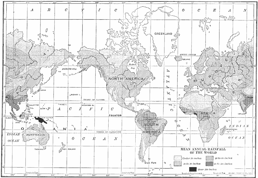
Description: A world map from 1910 showing mean annual rainfall. The map is shaded to show areas where rainfall ranges from under 10 inches to areas where rain fall averages over 120 inches.
Place Names: A Complete Map of Globes and Multi-continent, Asia, �Africa, �Australia, �Europe, �North America, �South Americ
ISO Topic Categories: climatologyMeteorologyAtmosphere,
location,
oceans,
inlandWaters
Keywords: Mean Annual Rainfall of the World, physical, �meteorological, kClimate, physical features, rainfall, climatologyMeteorologyAtmosphere,
location,
oceans,
inlandWaters, Unknown, 1910
Source: Ralph S. Tarr, B.S., F.G.S.A. and Frank M. McMurry, Ph.D., New Geographies 2nd ed (New York, NY: The Macmillan Company, 1910) 212
Map Credit: Courtesy the private collection of Roy Winkelman |
|