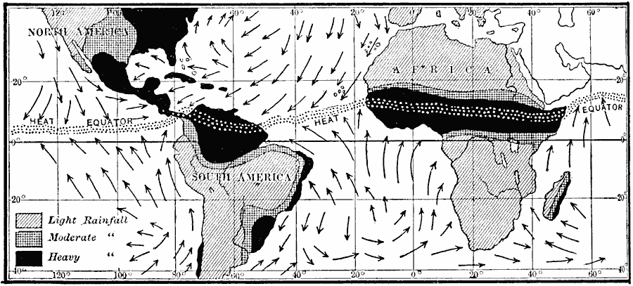
Description: A map of South America and Africa from 1910 showing the prevailing wind directions and mean rainfall patterns from June to August. The map shows the heat equator situated in the northern hemisphere, and regions where rainfall is light, moderate, and heavy during this season.
Place Names: Regional Miscellaneous, South America, �North America, �Afric
ISO Topic Categories: physical, �meteorological, kClimate, kWorldAtlantic, kWorldPacific
Keywords: Winds and Rain in South America and Africa from June to August, physical, �meteorological, kClimate, physical features, rainfall,
winds, physical, �meteorological, kClimate, kWorldAtlantic, kWorldPacific, Unknown, 1910
Source: Ralph S. Tarr, B.S., F.G.S.A. and Frank M. McMurry, Ph.D., New Geographies 2nd ed (New York, NY: The Macmillan Company, 1910) 214
Map Credit: Courtesy the private collection of Roy Winkelman |
|