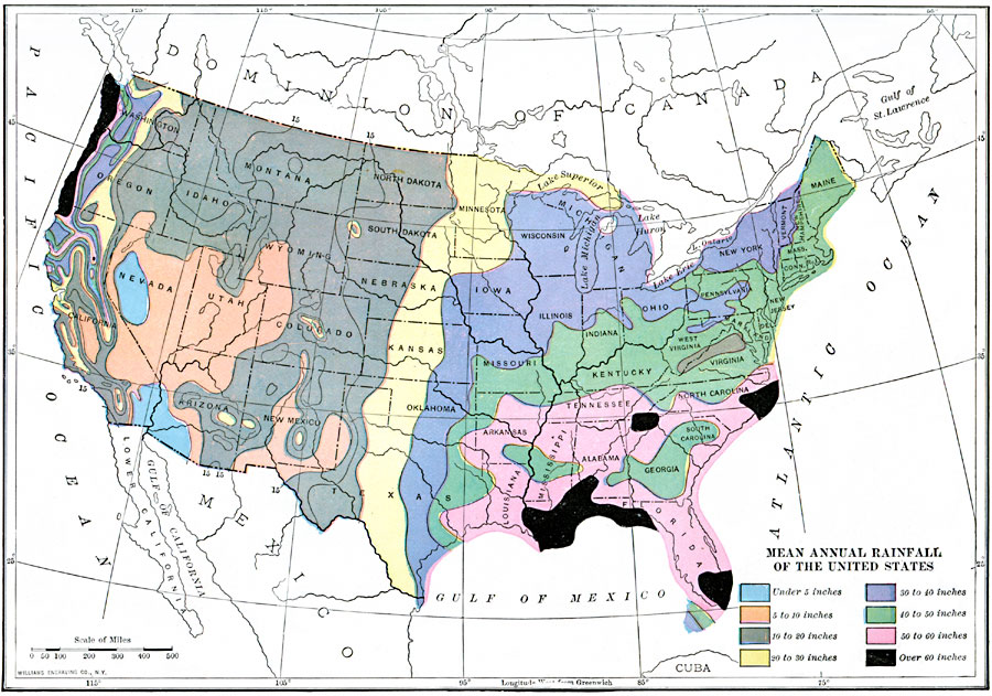
Description: A map from 1910 of the United States showing the mean annual rainfall distribution. The map is color–coded to show areas of rainfall ranging from under 5 inches annually to over 60 inches.
Place Names: Meteorology, rainfal
ISO Topic Categories: boundaries,
location,
oceans,
inlandWaters,
climatologyMeteorologyAtmosphere
Keywords: Mean Annual Rainfall of the United States, physical, �political, �meteorological, kClimate, physical features, country borders,
major political subdivisions, rainfall, boundaries,
location,
oceans,
inlandWaters,
climatologyMeteorologyAtmosphere, Unknown, 1910
Source: Ralph S. Tarr, B.S., F.G.S.A. and Frank M. McMurry, Ph.D., New Geographies 2nd ed (New York, NY: The Macmillan Company, 1910) 214
Map Credit: Courtesy the private collection of Roy Winkelman |
|