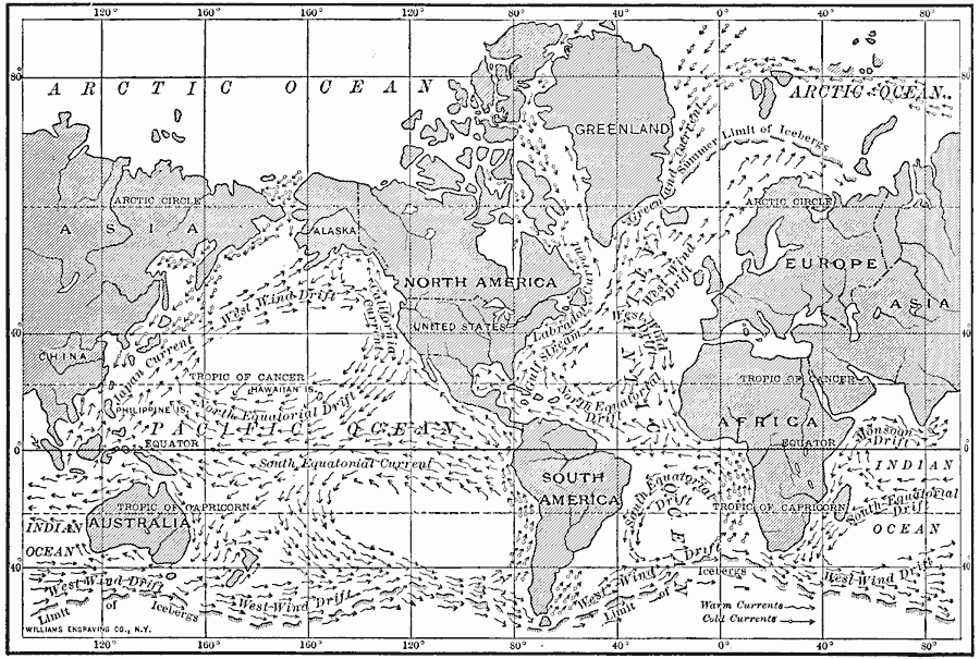
Description: A chart from 1910 showing the principal ocean currents and ocean drifts of the world. The map shows both warm and cold currents and direction of flow for the Gulf Stream, Labrador, Greenland, Japan, California, and South Equatorial currents, the West Wind, Monsoon, North Equatorial and South Equatorial drifts, and the northern and southern limits of icebergs.
Place Names: A Complete Map of Globes and Multi-continent, Africa, �Asia, �Australia, �Europe, �North America, �South Americ
ISO Topic Categories: boundaries,
inlandWaters,
location,
oceans
Keywords: Currents and Drifts of the Oceans, political, �physical, �hydrological, physical features, country borders, currents, boundaries,
inlandWaters,
location,
oceans, Unknown, 1910
Source: Ralph S. Tarr, B.S., F.G.S.A. and Frank M. McMurry, Ph.D., New Geographies 2nd ed (New York, NY: The Macmillan Company, 1910) 220
Map Credit: Courtesy the private collection of Roy Winkelman |
|