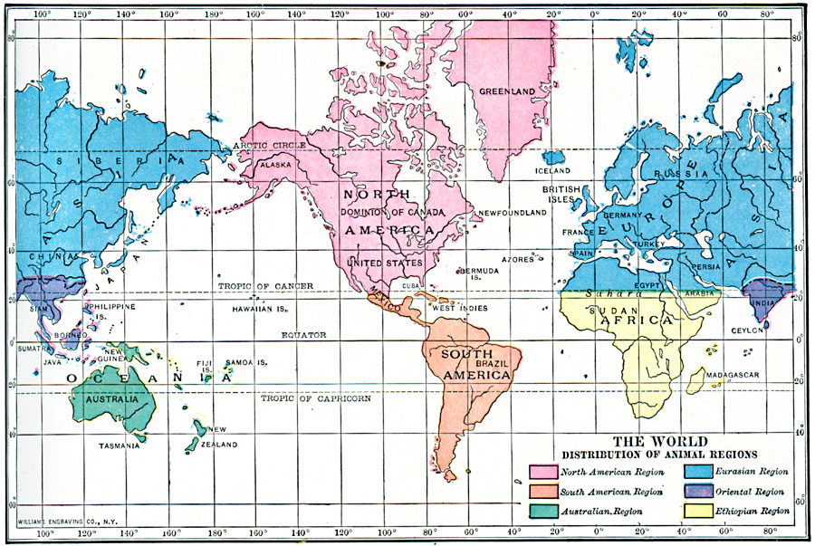
Description: A map of the world from 1910, showing the geographic distribution of animal regions broken down as the North American, South American, Australian, Eurasian, Oriental, and Ethiopian regions.
Place Names: A Complete Map of Globes and Multi-continent, Africa, �Asia, �Australia, �Europe, �North America, �South Americ
ISO Topic Categories: biota,
oceans,
location,
inlandWaters
Keywords: Animal Regions of the World, physical, kBiodiversity, physical features, biota,
oceans,
location,
inlandWaters, Unknown, 1910
Source: Ralph S. Tarr, B.S., F.G.S.A. and Frank M. McMurry, Ph.D., New Geographies 2nd ed (New York, NY: The Macmillan Company, 1910) 230
Map Credit: Courtesy the private collection of Roy Winkelman |
|