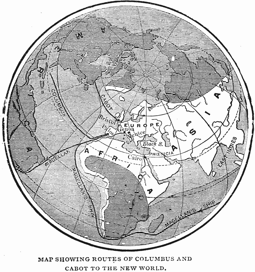
Description: A global map from 1887 showing the routes of Christopher Columbus (1492) and John Cabot (1497) to the New World, and the circumnavigation route of Ferdinand Magellan (1519–1522). The map is shows the known world (by Europeans) at the time in white, and the unknown world shaded.
Place Names: Regional Miscellaneous, Africa, �Asia, �East Indies, �Europe, �North America, �South America,
ISO Topic Categories: historical, �routes, kWorldAtlantic, kWorldEurasia, kWorldEuroAfrica
Keywords: Map Showing Routes of Columbus, Magellan, and Cabot to the New World, historical, �routes, water routes, historical, �routes, kWorldAtlantic, kWorldEurasia, kWorldEuroAfrica, Unknown, 1492–1522
Source: Henry E. Chambers, A School History of the United States, From the Discovery of Columbus to the Present Time, with Review Outlines, Blackboard Forms and Other Devices to Aid in the Successful Presentation of the Subject. (New Orleans, Louisiana: F. F. Hansel & Brothers, 1887) 23
Map Credit: Courtesy the private collection of Roy Winkelman |
|