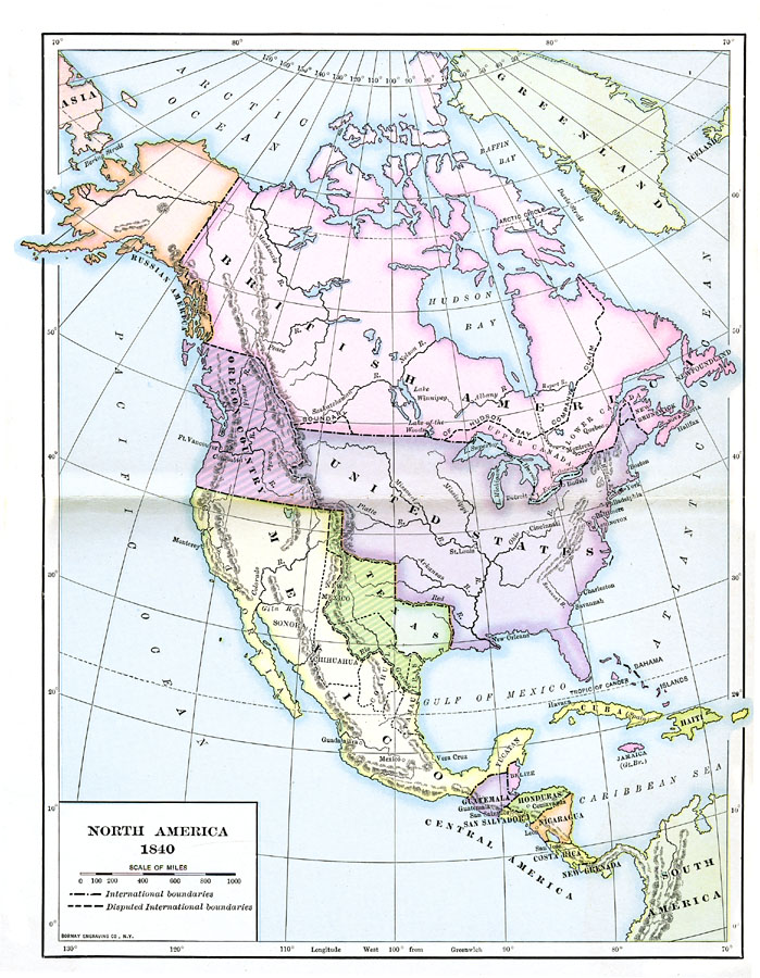
Description: A map of North America in 1840 at the time when the concept of "Manifest Destiny" was being applied to annex the Oregon Territory, Texas, and much of northern Mexico into the United States. The map is color–coded to show the extent of the United States, British America (Canada), and Mexico at the time, the Oregon Territory and the Republic of Texas, and shows both accepted and disputed international boundaries.
Place Names: A Complete Map of North America, Bahamas, �Canada, �Cuba, �Mexico, �United States, �Haiti, �Guatemala, �Honduras, �Costa Ric
ISO Topic Categories: boundaries,
oceans,
location,
inlandWaters
Keywords: North America, physical, �political, physical features, major political subdivisions, boundaries,
oceans,
location,
inlandWaters, Unknown, 1840
Source: Albert Bushnell Hart, LL.D., The American Nation (New York, NY: Harper and Brothers, 1906) 4
Map Credit: Courtesy the private collection of Roy Winkelman |
|
