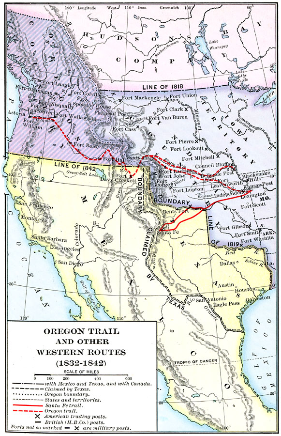
Description: A map of western North America between the opening of the Oregon Trail in 1832 to 1842, prior to the establishment of the Provisional Government of Oregon by American settlers in 1843. The map shows the boundary of the Oregon Country, the boundary line between British territory under the Hudson Bay Company claims and the United States as established in 1818, the boundary line between the United States and Spain established by the Adams–Onis Treaty of 1819, the boundary line between Oregon Country and Mexico in 1842, and the boundary claimed by Texas, the extent of the Iowa Territory, the Indian Territory, and the western borders of Missouri, Arkansas, and Louisiana at the time. The map shows the routes of the Oregon Trail and the Santa Fe Trail, American trading posts, Hudson Bay Company posts, military forts, and early settlements, mountain systems, and rivers of the region.
Place Names: A Regional Map of North America, Mexico, �United States, �Canad
ISO Topic Categories:
Keywords: Oregon Trail and Other Routes, political, �physical, �transportation, physical features, country borders,
major political subdivisions, roads, Unknown, 1832–1842
Source: Albert Bushnell Hart, LL.D., The American Nation (New York, NY: Harper and Brothers, 1906) 36
Map Credit: Courtesy the private collection of Roy Winkelman |
|