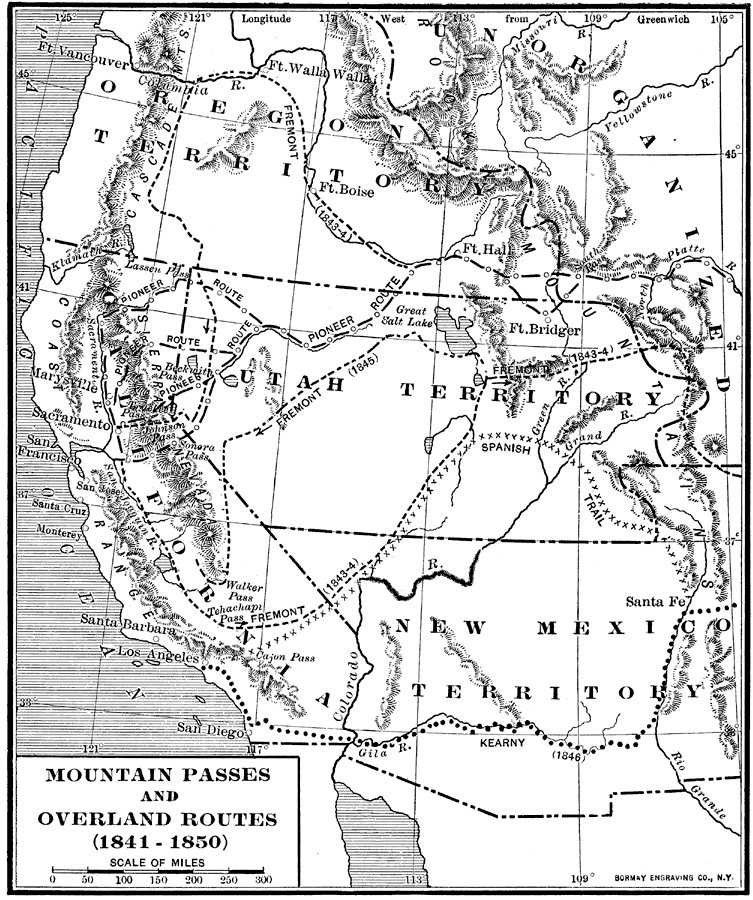
Description: A map of the Pacific region of the United States west of the Rocky Mountains in 1841–1850. The map shows the Old Spanish Trail from Los Angeles to Santa Fe, the Pioneer Route from the Platte River to San Francisco, the routes of Fremont (1843–1845), and the route of Kerry from San Diego east during the Mexican–American War (1846).
Place Names: Growth of Nation, San Diego, �Los Angele
ISO Topic Categories: boundaries,
inlandWaters,
location,
oceans,
transportation
Keywords: Mountain Passes and Overland Routes in the West, physical, �political, �transportation, physical features, country borders,
major political subdivisions, roads, boundaries,
inlandWaters,
location,
oceans,
transportation, Unknown, 1841–1850
Source: Albert Bushnell Hart, LL.D., The American Nation (New York, NY: Harper and Brothers, 1906) 230
Map Credit: Courtesy the private collection of Roy Winkelman |
|
