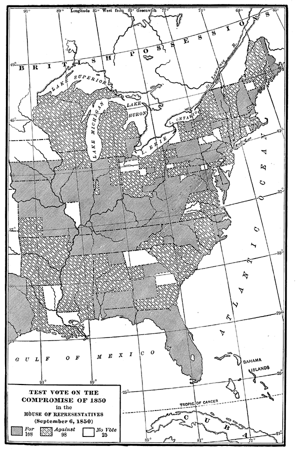
Description: A map of the United States showing the results of a test vote of the Compromise of 1850 in the House of Representatives. The Compromise of 1850 was a series of bills attempting to resolve the territorial slavery controversy following the Mexican–American War and admission of territories relating to their status as slave holding areas. The map is keyed to show the vote results in areas for, against, and non–voting.
Place Names: Elections,
ISO Topic Categories: boundaries,
inlandWaters,
location,
oceans
Keywords: Test Vote of Compromise of 1850, physical, �political, physical features, country borders,
major political subdivisions, boundaries,
inlandWaters,
location,
oceans, Unknown, 1850
Source: Albert Bushnell Hart, LL.D., The American Nation (New York, NY: Harper and Brothers, 1906) 328
Map Credit: Courtesy the private collection of Roy Winkelman |
|