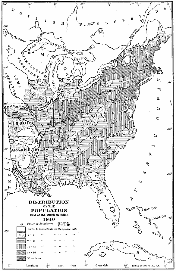
Description: A map of the central and eastern United States in 1840 showing the distribution of the population in the region at the time. The map shows State lines, the frontier line in 1840, and is keyed to show the areas of population density ranging from under 2 inhabitants per square mile to areas with 90 and over inhabitants per square mile. The mean center of population is shown near Clarksburg in Upshur County, Virginia (now West Virginia) according to the census of 1840.
Place Names: Demographics, populatio
ISO Topic Categories: boundaries,
inlandWaters,
location,
oceans,
society
Keywords: Population, statistical, �political, kPopulation, country borders,
major political subdivisions, population, boundaries,
inlandWaters,
location,
oceans,
society, Unknown, 1840
Source: Albert Bushnell Hart, LL.D., The American Nation Vol.16 (New York, NY: Harper and Brothers, 1906) 8
Map Credit: Courtesy the private collection of Roy Winkelman |
|