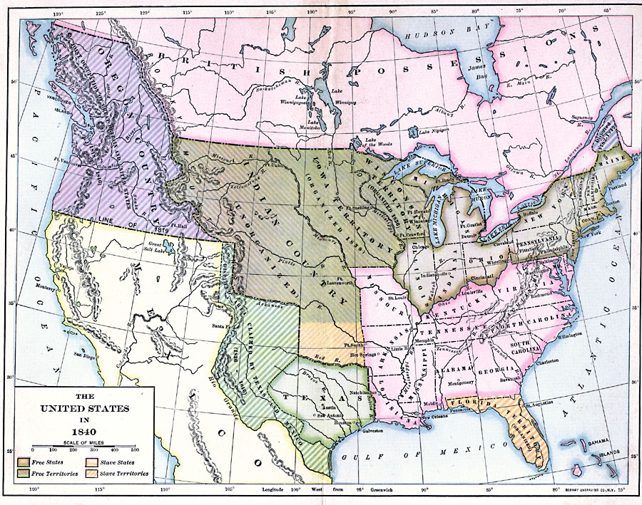
Description: A map of the United States in 1840 showing the State and territory boundaries, the Oregon Country jointly controlled by Great Britain and the United States, and the Mexican possessions at the time. The map is color–coded to show the free states and territories, and the slave holding states and territories.
Place Names: Growth of Nation,
ISO Topic Categories: boundaries,
inlandWaters,
location,
oceans
Keywords: The United States, political, �physical, physical features, country borders,
major political subdivisions, boundaries,
inlandWaters,
location,
oceans, Unknown, 1840
Source: Albert Bushnell Hart, LL.D., The American Nation Vol.16 (New York, NY: Harper and Brothers, 1906) 53
Map Credit: Courtesy the private collection of Roy Winkelman |
|