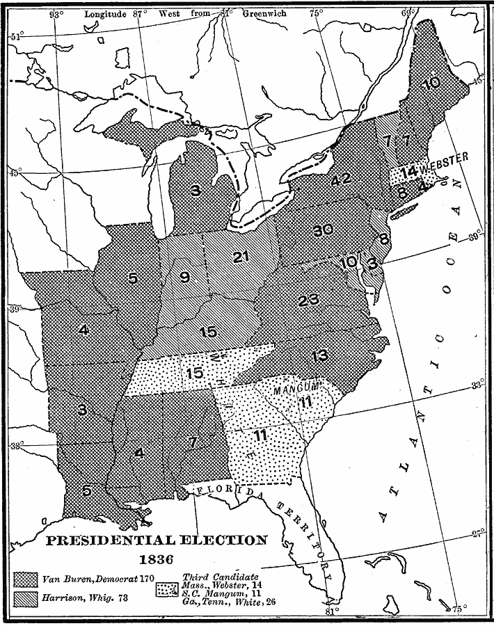
Description: A map of the United States showing the results of the presidential election of 1836. The map is keyed to show the states carried by Van Buren (Democrat), Harrison (Whig Party – West), and the third candidates White (Whig Party – South), Webster (Whig Party – New England), and Magnum (Whig Party – South Carolina). The figures indicate the number of Electoral Votes for each State.
Place Names: Elections,
ISO Topic Categories: boundaries,
location,
oceans,
inlandWaters
Keywords: Presidential Election, physical, �political, physical features, country borders,
major political subdivisions, boundaries,
location,
oceans,
inlandWaters, Unknown, 1836
Source: Albert Bushnell Hart, LL.D., The American Nation Vol.16 (New York, NY: Harper and Brothers, 1906) 300
Map Credit: Courtesy the private collection of Roy Winkelman |
|