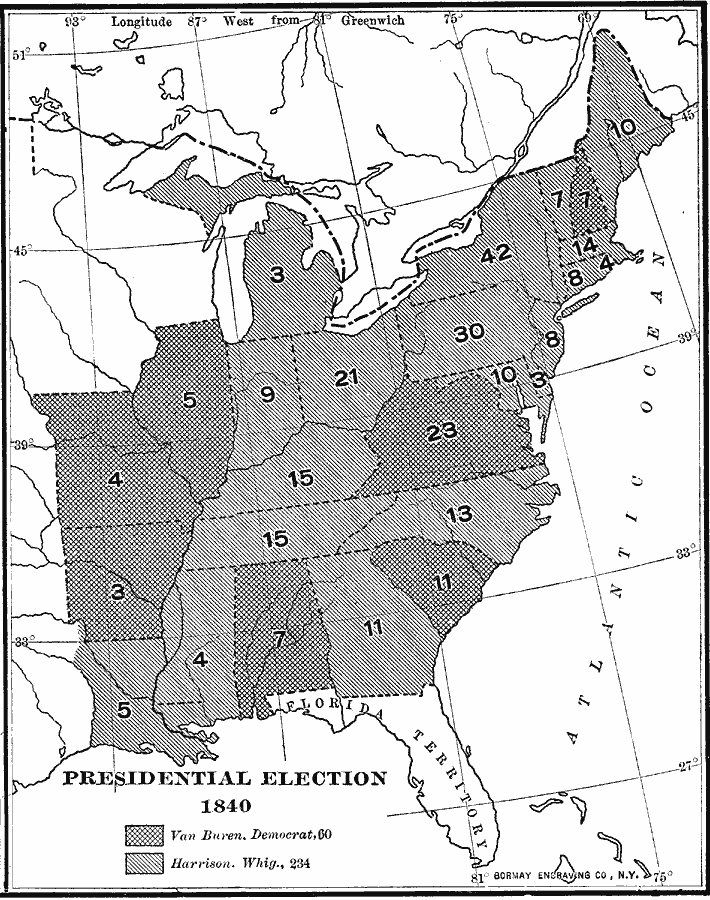
Description: A map of the United States showing the results of the presidential election of 1840. The map is keyed to show the states carried by Harrison (Whig Party), and Van Buren (Democrat). The Whig Party was united at this time, backing Harrison, a hero of the Tecumseh Rebellion and Battle of Tippecanoe, and his running mate John Tyler, rallying under the slogan "Tippecanoe and Tyler, too." The figures indicate the number of Electoral Votes for each State.
Place Names: Elections,
ISO Topic Categories: boundaries,
location,
oceans,
inlandWaters
Keywords: Presidential Election, physical, �political, physical features, country borders,
major political subdivisions, boundaries,
location,
oceans,
inlandWaters, Unknown, 1840
Source: Albert Bushnell Hart, LL.D., The American Nation Vol.16 (New York, NY: Harper and Brothers, 1906) 300
Map Credit: Courtesy the private collection of Roy Winkelman |
|