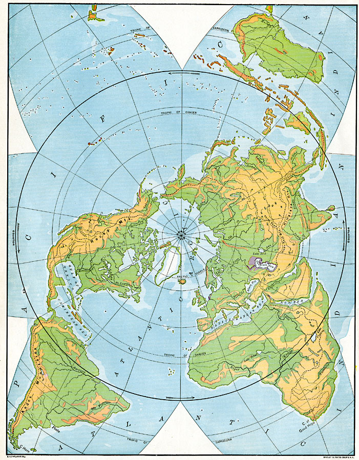
Description: A world map from 1901 on a Polar Projection showing general land elevations to illustrate continental slopes and divides. The map is color-coded to show mountain systems and high plateaus in tan, lowlands in green, submerged continental plateau in light blue, and deeper waters in dark blue. Land which is below sea level, such as around the Caspian Sea, is shown in purple. Major rivers are also shown on the map. "Any region from which the land slopes downward in two opposite directions is called a water-parting, or divide, because the water which falls on it is divided, part of it flowing down one slope and part down the other. The crest of every mountain range is a divide, and so too is the crest of every imperceptible swell of land – from both the surface water flows in opposite directions. Every stream basin is partly surrounded by a divide, from which water flows down into the stream, and by which the basin is separated from adjoining basins. The streams which rise in the great highlands of the world flow down toward the Atlantic and Arctic oceans on one side, toward the Pacific Ocean on another side, and toward the Indian Ocean on the third side. The highland region may therefore be said to separate the continental plateau into three main slopes: (1) the Arctic-Atlantic slope; (2) the Pacific slope; (3) the Indian Ocean slope. The crest or meeting of any two of these slopes may be called a continental divide." — Redway, 1901, p. 17.
Place Names: A Complete Map of Globes and Multi-continent, Africa, �Asia, �Australia, �Europe, �North America, �South Americ
ISO Topic Categories: inlandWaters,
oceans
Keywords: World- Slopes and Divides Polar Perspective, physical, kMapProjection, physical features, inlandWaters,
oceans, Unknown, 1901
Source: Jacques W. Redway, Natural Advanced Geography (New York, New York: American Book Company, 1901) 16
Map Credit: Courtesy the private collection of Roy Winkelman |
|