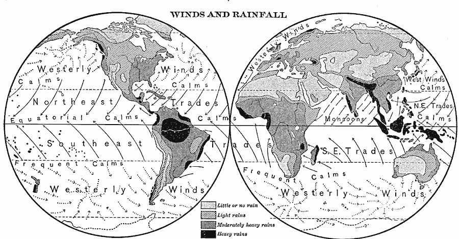
Description: A map of the Western and Eastern hemispheres from 1901, showing the prevailing winds of the Trades, the areas of calms, the seasonal wind directions of the Monsoons, and the cyclonic patterns of the Westerlies. This map also shows continental rainfall distribution patterns, showing areas of little or no rain, light rains, moderately heavy rains, and areas of heavy rains.
Place Names: A Complete Map of Globes and Multi-continent, Africa, �Antarctica, �Asia, �Australia, �Europe, �North America, �South Americ
ISO Topic Categories: climatologyMeteorologyAtmosphere,
inlandWaters,
oceans
Keywords: Prevailing Winds and Rainfall Distribution, physical, �meteorological, kClimate, physical features, climate,
winds, climatologyMeteorologyAtmosphere,
inlandWaters,
oceans, Unknown, 1901
Source: Jacques W. Redway, Natural Advanced Geography (New York, New York: American Book Company, 1901) 26
Map Credit: Courtesy the private collection of Roy Winkelman |
|