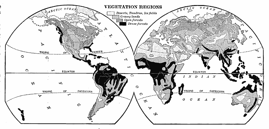
Description: A word map from 1901 showing the Vegetation Regions over the Earth. This map shows regions of deserts, tundras, and ice fields in white, regions of grassy lands in light gray, regions of open forests in dark gray, and regions of dense forests in black.
Place Names: A Complete Map of Globes and Multi-continent, Arctic Circle, �Tropic of Cancer, �Equator, �Tropic of Capricorn, �Atlantic Ocean, �Pacific Ocean, �Indian Ocean, �Arctic Ocean, �Africa, �Asia, �Australia, �Europe, �North America, �South Americ
ISO Topic Categories: biota,
inlandWaters,
oceans,
location
Keywords: World Vegetation Regions, physical, �statistical, physical features, vegetation, biota,
inlandWaters,
oceans,
location, Unknown, 1901
Source: Jacques W. Redway, Natural Advanced Geography (New York, New York: American Book Company, 1901) 28
Map Credit: Courtesy the private collection of Roy Winkelman |
|
