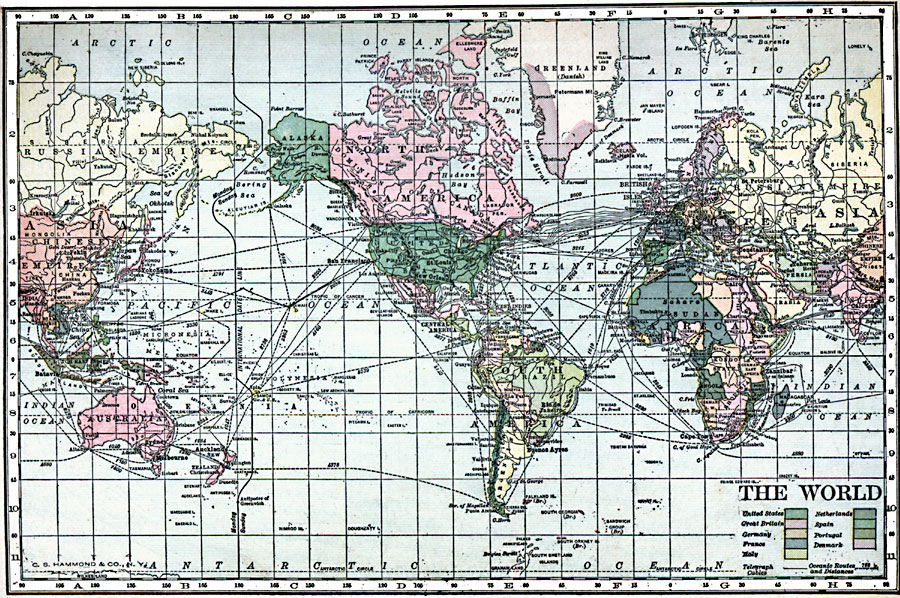
Description: A world map from 1901 showing the International Date Line, submarine telegraph cables and oceanic steamship routes with distances between major ports. The map is color–coded to show the territorial possessions of the United States, Great Britain, Germany, France, Italy, Netherlands, Spain, Portugal, and Denmark at the time.
Place Names: A Complete Map of Globes and Multi-continent, Africa, �Antarctica, �Asia, �Australia, �Europe, �North America, �South Americ
ISO Topic Categories: oceans,
location,
inlandWaters
Keywords: The World, country borders, �transportation, �water routes, �country borders, water routes, oceans,
location,
inlandWaters, Unknown, 1910
Source: C. S. Hammond, Hammond's Handy Atlas of the World (New York, New York: C. S. Hammond & Company, 1911) 3
Map Credit: Courtesy the private collection of Roy Winkelman |
|