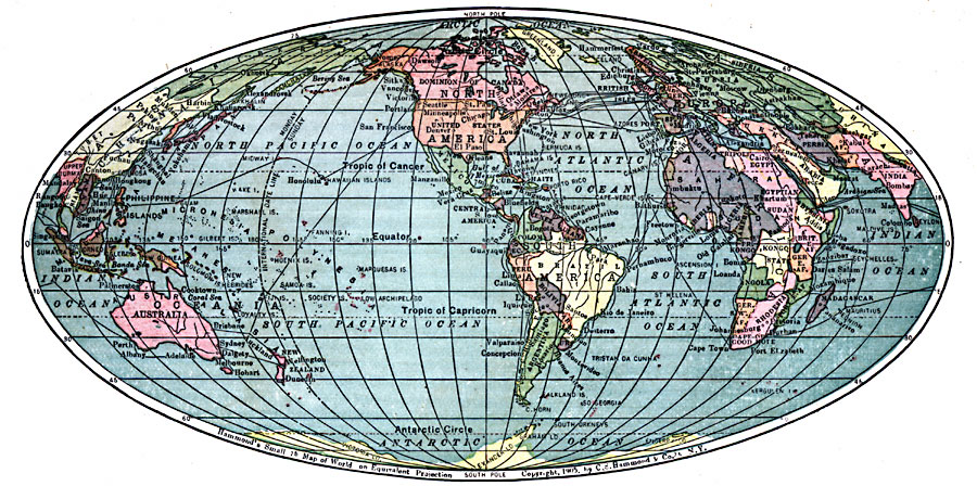
Description: A world map from 1911 showing the earth on an Equivalent Projection (preserves relative size of areas, but distorts shape, particularly in the higher latitudes). The map shows national borders, major cities, and submarine cable routes. "This new map presents a comprehensive view of the superficial area of the Earth, not unlike that which would be displayed by the printed cover of a globe, if removed and flattened."
Place Names: A Complete Map of Globes and Multi-continent, Africa, �Antarctica, �Asia, �Australia, �Europe, �North America, �Oceania, �South Americ
ISO Topic Categories: oceans,
location,
inlandWaters
Keywords: Map of the World on the Equivalent Projection, country borders, �submarine cables, �transportation, kMapProjection, country borders, water routes, oceans,
location,
inlandWaters, Unknown, 1911
Source: C. S. Hammond, Hammond's Handy Atlas of the World (New York, New York: C. S. Hammond & Company, 1911) 4
Map Credit: Courtesy the private collection of Roy Winkelman |
|