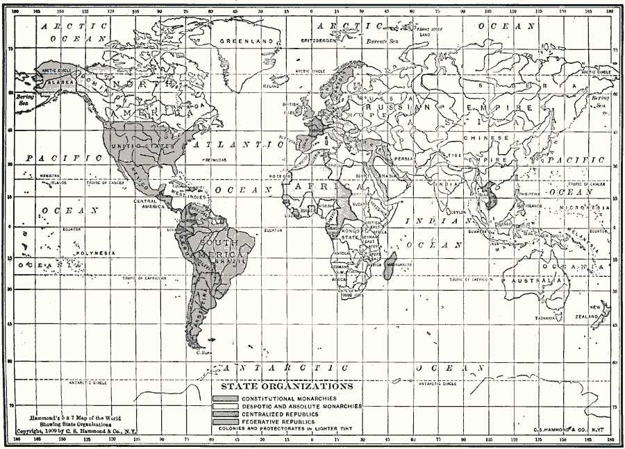
Description: A world map from 1909 showing the "State Organizations" or national political systems of the time. The map is color–coded to show countries under constitutional monarchies (pink), despotic and absolute monarchies (yellow), centralized republics (green), and federative republics (orange). Countries under colonial or protectorate status are shown with lighter tints of their controlling country, such as the Philippine Islands and Cuba (ceded to the United States by Spain in 1898) shown in light orange, or India under Britain shown in light pink.
Place Names: A Complete Map of Globes and Multi-continent, Africa, �Antarctica, �Asia, �Australia, �Europe, �North America, �Oceania, �South Americ
ISO Topic Categories: oceans,
location,
inlandWaters
Keywords: State Organizations, country borders, �political, �state organizations, �country borders,
major political subdivisions, oceans,
location,
inlandWaters, Unknown, 1909
Source: C. S. Hammond, Hammond's Handy Atlas of the World (New York, New York: C. S. Hammond & Company, 1911) 5
Map Credit: Courtesy the private collection of Roy Winkelman |
|